Virtual Worlds, Really
Dateline: 1/12/98
 One of the most
intriguing applications for VRML, and virtual environments in general,
are the representations of real places, the earth, cities, buildings. These
places can be used as a natural, intuitive user interface a front-end for
information access about those worlds. The earth makes a natural user interface
to find out information about any place. With a virtual earth you just
spin the world and select the point of interest.
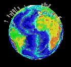
An ambitious project to create just such an earth interface is called
the World of Worlds (WOW). Brought
to us by Richard Tilmann of Mesh Mart this
project was truly visionary. As you zoom into a particular portion of the
globe spotlights mark areas with more information. Zoom in further and
more detail, via the Level Of Detail (LOD), capability of VRML, presents
more detailed representations of the land. The WOW reference globe is organized
into three levels of detail, the entire globe, patches of land with markers
and finally topological models of 5 degree sections of the earth. At the
most detailed level of the globe there are Red markers to indicate registered
sites. A registered site is a VRML model of some physical structure of
place created by anyone.
Setting up a methodology to enable site registration is another brilliant
aspect of WOW. It can grow and evolve with free labor! In addition to the
information entered by site creators other reference sources are used to
enhance the WOW registered sites. To quote from the WOW introduction page:
Several Web sites have been especially useful and helpful in the
World of World's project. These are listed
below.
-
ETOPO-5 Map Generator
provides the local topographical patches and textures.
-
Virtual Cities Repository (seems to be gone) has helped to keep the
list of reference sites current and growing.
-
Yahoo! provides the links to Web
pages and maps relevant to the site.
-
TIGER Mapping Service from the
US Census Bureau.
One VRML company in particular Planet
9 Studios specializes in the creation of virtual cities. They've
created over 100! Some other VRML concepts that I'll cover in future features
are demos giving users access to the news around the world and almost live
satellite images over the globe. All of these extend the same idea of using
virtual representations of real physical places to access information.
Previous
Features
 One of the most
intriguing applications for VRML, and virtual environments in general,
are the representations of real places, the earth, cities, buildings. These
places can be used as a natural, intuitive user interface a front-end for
information access about those worlds. The earth makes a natural user interface
to find out information about any place. With a virtual earth you just
spin the world and select the point of interest.